


LakeNavi shows how deep the water is for the boat you are in, and works with no signal. We need Table Rock boaters to run missions on trips they are already taking, and tell us where the chart is right and where it is wrong.
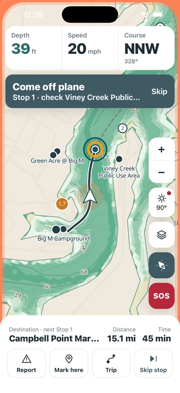
Real screens from the build testers get.
This is one real mission, screen by screen. You pick where you are going. The app picks the stops, tells you when to slow down, and asks one short question at each.
Swipe to follow the trip.
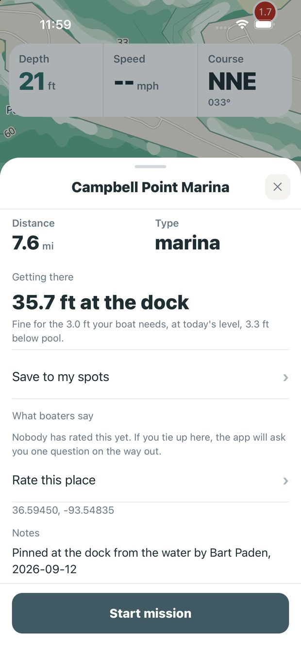
Search for a marina, a cove or a saved spot, and tap Start mission. That is the only choice you make.
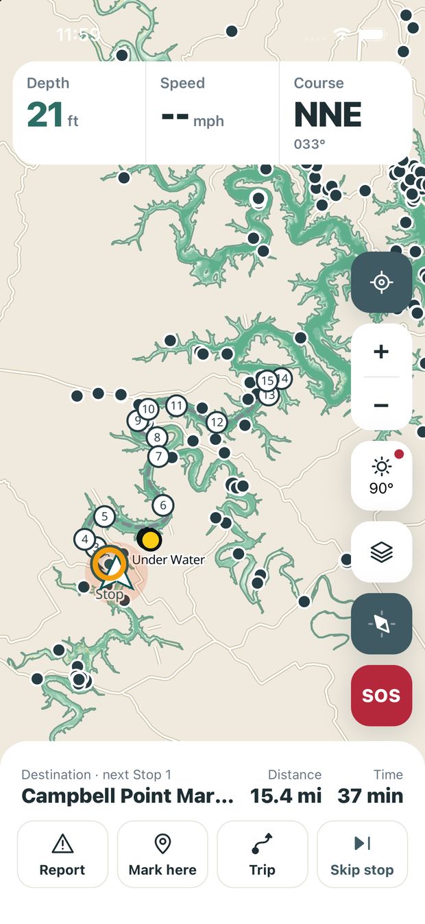
Between 5 and 15, along your route, where the chart most needs checking. Everyone's stops are different.
About a quarter mile out, the screen edge glows and a banner says what the next stop is. Come off plane when it is safe.
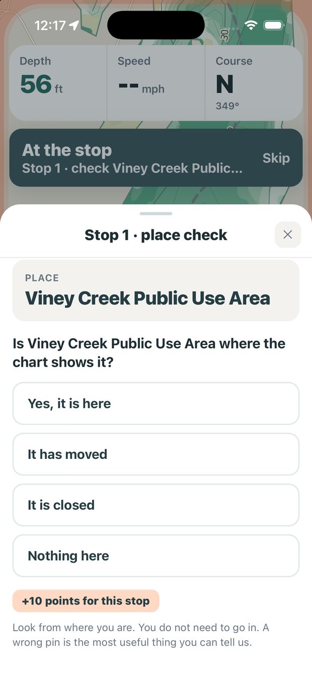
This one is a place check. Look from where you are and tap an answer. You never have to go in.
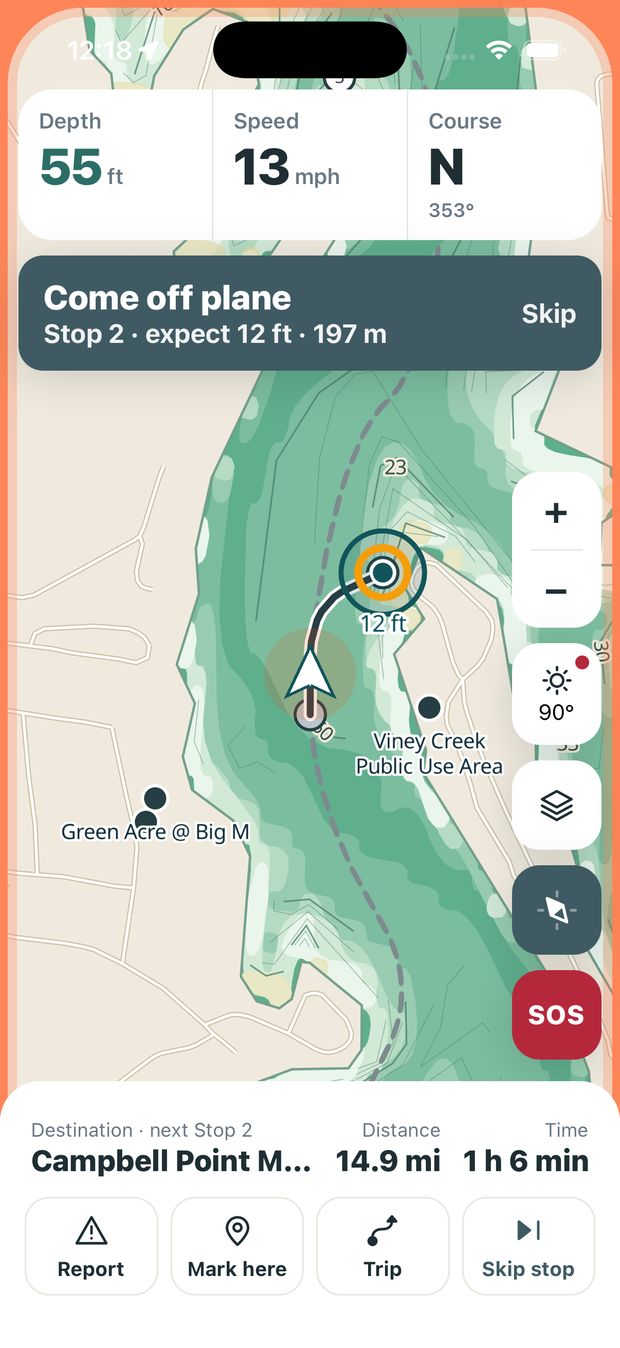
The route moves to the next stop on its own and tells you what to expect there, like 12 feet.
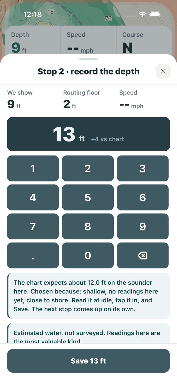
A depth stop opens a keypad. Type what your sounder says at idle and save. About ten seconds.
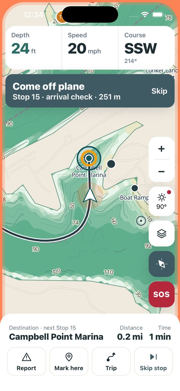
The last stop is where you were going. The glow comes back as you close on the marina.
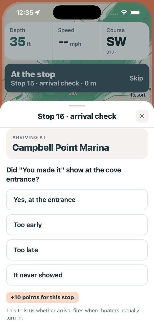
Did "You made it" show at the cove entrance, too early, too late, or not at all?
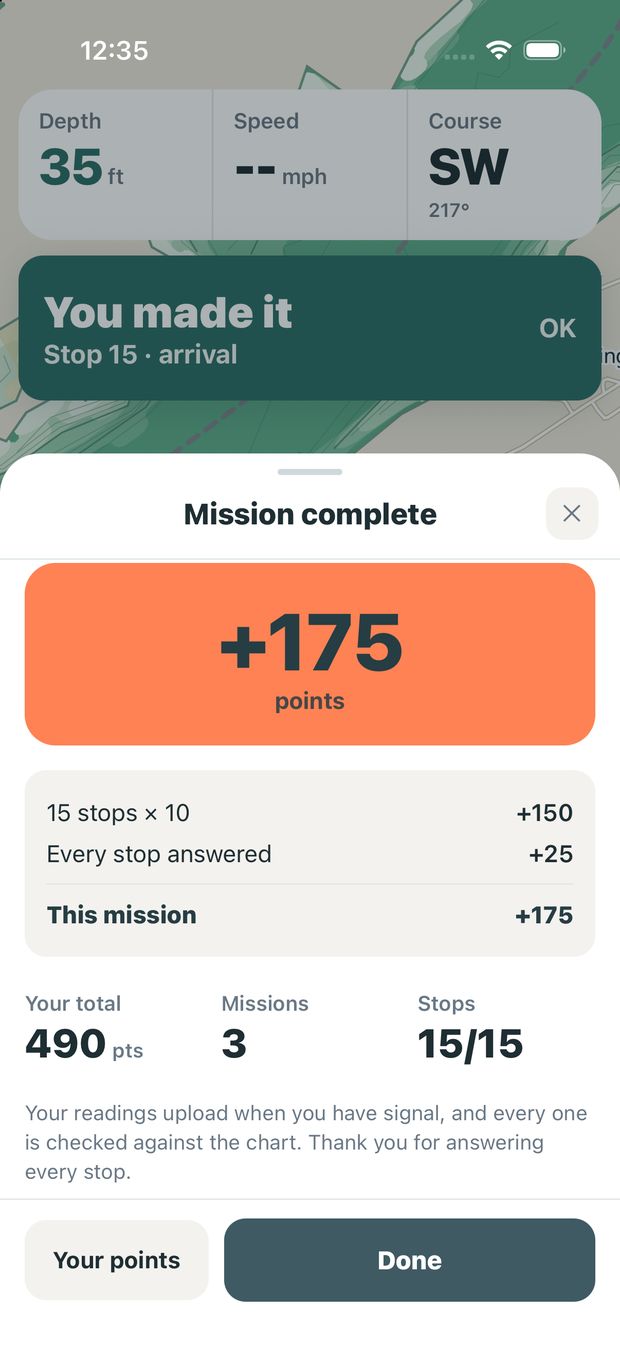
Your points for the run, how they add up, and your new total.
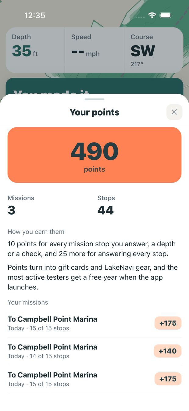
Under Me, then Your points: your total, every mission behind it, and the crew board.
Each stop asks one thing, and every stop earns the same 10 points. A mission mixes them, so no two runs feel the same.
At idle, read your depth finder and type the number. The stop tells you what the chart expects and why it picked that spot: a shallow flat, an uneven bottom, water nobody has read yet.
A marina, ramp or park the route passes. Look from the water and tell us whether it is where the chart puts it. A wrong pin is the most useful thing you can report.
At the end of every mission. The app should say "You made it" as you turn into the cove, not a mile early or once you are tied up. Tell us where it fired.
Once a mission, where your route runs tightest: closest to shore or shallow water. Look at the water around the line and your sounder, and tell us whether the route really holds to good water for your boat.
When another boater has reported debris, a hazard or a shallow spot beside your route, a stop asks whether it is still there. Reports go stale, and one nobody can find should stop warning people.
If a shallow-water, land or storm warning comes up during your mission, the app asks at your next stop whether it was right and on time. It is never asked while you are running. Worth 10 points each, up to three a mission.
Feedback from the water is the most valuable thing you send, and it takes seconds. A person on the team reads every one.
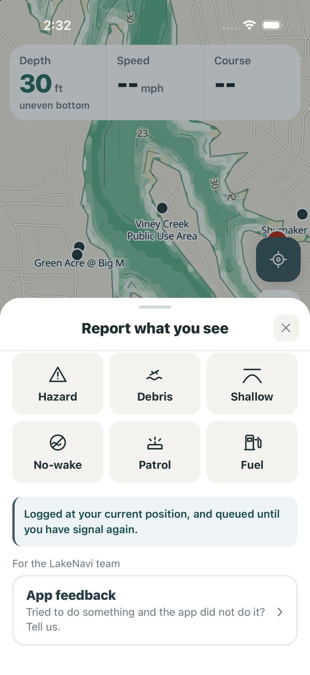
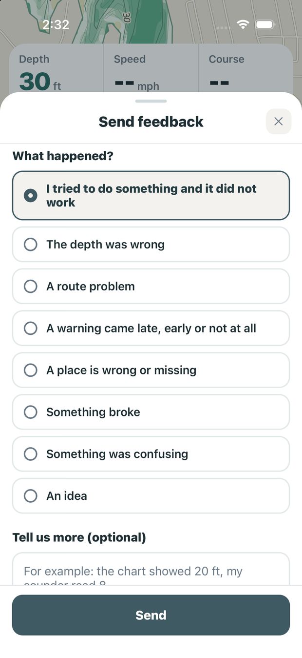
Your location is attached for you, so we can find the exact spot. No signal? It waits on your phone and sends itself later. You can also send feedback from Me, from Your points, and from the end of every mission.

Built on Table Rock, for the people who run it.
Testing runs through the fall, and the chart gets better with every mission.
Missions cover a lot of this for you. Between stops, use the app the way you normally would and notice where it falls short.
The chart shades safe water for how deep your boat sits. Compare it against your own depth finder and tell us where they disagree.
Does the route keep you in water deep enough, and is the time it gives you close to the time it took?
Shallow water ahead, land ahead, off-route alerts and storm warnings. We need to know if they fire late, early, or not at all.
The whole lake saves to your phone. In a dead cove, tell us if anything stops working. Readings wait and send when you have signal again.
Fuel, food and slips. Tell us about pins in the wrong spot and places we are missing.
Report debris in one tap so the next boater sees it. Check that what you report shows up, and that stale reports clear.
Every stop you answer earns points, and there is no cap. Points turn into gift cards and LakeNavi gear, and the most active testers get a free year when the app launches.
Testing is light, but it is real work that shapes the chart other boaters will trust. Here is what it takes, and what you can count on from us.
Test apps on iPhone install through TestFlight, Apple's free app for testing apps before they reach the App Store. It takes about five minutes, and we walk you through it.
Your name, email, boat and where you launch. Two minutes.
TodayThe moment you sign up, we load that exact email into TestFlight, and Apple emails an invitation to test LakeNavi to that address. If it is not in your inbox, check spam or promotions.
Usually within minutesGet TestFlight from the App Store. It is free and made by Apple. You only need it once.
One timeTap "View in TestFlight" in the email, then Accept and Install. Open the email on the phone, not a computer. LakeNavi then sits on your home screen like any other app.
If TestFlight opens without LakeNavi in it, go back to the Apple page the button opened and copy the redeem code there. In TestFlight, tap your photo, then Redeem Code, and paste it.
One tapOpen LakeNavi and enter that same email. We send an 8-digit code, so there is no password to lose on the dock. Open the app once with good signal before you head out so the lake saves to your phone.
Before your first tripPick where you are going and tap Start mission. In TestFlight, turn on automatic updates so fixes reach you on their own.
Next time you are outStuck at any step? Send us a question and a person will help you get set up.
Any kind. Pontoon, bass boat, wake boat, cruiser or houseboat. The chart reads differently for each, which is the point.
Testing runs through Apple's TestFlight for now. Android comes later, and you can sign up today to hear first.
It is not required. Place and arrival checks need only your eyes, but depth readings are worth the most.
At least three missions over about six weeks, and as many more as you want to run.
You are the captain. The chart is a planning aid, and during testing it is an unfinished one.
Floating debris, stumps that arrived after 2020, other boats, swimmers and weather that turns fast are on no chart. Your eyes and your sounder come first.
Deep water has been checked against real sounder readings. The shallows are exactly what this round of testers is checking.
No ads, and we do not sell your location. Readings are used to improve the chart. Read the privacy policy.
Tap Report at the bottom left, then App feedback. Pick what happened, add a sentence if you like, and send. Your location goes with it, and it sends itself later if you have no signal. A person reads every one.
Tap Me, then Your points. You see your total, every mission behind it, and the crew board: the top ten testers by first name and initial, with missions and points and nothing about where anyone went.
As long as the trip you were already taking. The stops sit along your route, and each one takes a few seconds to answer. The only extra time is coming off plane for a moment at each stop.
Yes, any stop, any time, with Skip stop. If you drive past one, the app counts it as missed and moves on to the next. You keep the points for everything you answered. Only the finishing bonus needs every stop.
Tap End mission (Trip, then Field test tools), and you keep points for every stop you answered. If the app closes or your phone dies mid-mission, it offers the mission back next time you open it: keep going, or end it and bank what you did.
No. Tell the app you have none and your missions are checks only: places, the route, hazards and arrival, all answered by eye and worth the same points. A depth finder adds depth stops, the readings the chart needs most.
No. We ask for at least three missions, and the more you run, the more points you earn. The most active testers get a free year when the app launches.
Yes. The whole lake saves to your phone, and your answers wait on the phone until you have signal again, then send on their own.
Not in this round. Sign up anyway and choose Android, and you will hear first when Android testing opens.
TestFlight is Apple's own app for testing iPhone apps before they reach the App Store. It is free, and every test build goes through Apple before it reaches you.
This round runs through the fall. Your points and your free access carry over to launch.
Tell us a little about your boat so we can match missions to the water you actually run.
Not sure your boat suits it, or stuck getting TestFlight going? Send a question. A person reads these, and you will get a straight answer back.
If you already know you want in, use the tester form instead.